Wednesday 29 May 2019

And so to Lincoln

We are now moored just off the Brayford Pool in Lincoln, having come in to the city about lunch time.  Here is an update with some pictures of our progress.
Last Sunday, after saying goodbye to our visitors, we cycled into Tattershall and visited the castle.  It was built in the 1400s of brick which was an unusual building material for a multi-storey building at the time. They were having a special medieval re-enactment day, hence the tents.

From the top of Tattershall Castle we could see Boston Stump to the east and, as shown in this picture, Lincoln Cathedral to the west.

This photo is taken from Leo moored by Tattershall Bridge at 10 o'clock at night.  Plenty of daylight now!

On Monday we cruised upriver to Woodhall Spa and cycled into the town.  Some passers by a few days ago had recommended a visit to the Petwood Hotel  which was taken over in the 1940s for use as the Officers' Mess of the Dambusters Squadron 617.  This is the Dambusters room at the hotel and has lots of displays including, over the bar, a pine branch which came through the cockpit of a Lancaster on the raid when it clipped some trees.  The hotel is well worth a visit and the lady at reception seemed accustomed to people asking to visit the room.

In the garden of the hotel is an early prototype of the famous bouncing bomb.

The gardens of the hotel are delightful. The rhododendrons were in flower and looked glorious.

Here is a view of the hotel building (dating from the early 1900s) from the garden.

Cruising along the River Witham there are a number of sculptures beside the cycle route that runs along the disused railway alongside the river.  This is the lady sculpted out of wood.

We moored last night at Fiskerton Fen, a nature reserve, where a mooring pontoon has been provided.  Leo is the boat further away in this photo.

We walked through the reserve to a bird hide and stayed for a while watching the bird life.  This reed bunting kept perching in a willow tree and singing.

We have had some heavy showers lately and we were expecting this one to give us a good soaking.  Fortunately we were back on Leo by the time the rain came.

Today (Wednesday 29th) we cruised into Lincoln.  The cathedral is a landmark for miles across the flat landscape.  Here we could see it clearly from 10 km away.  Though the surrounding land is very flat, Lincoln Cathedral and Castle were built at the top of a very steep hill.

Here is another of the waterside sculptures representing ears of barley.  There are also two iron cows.

There is quite a lot of weed in the River Witham at the moment so it was good to see this weedcutter boat trying to clear some of it.

Having passed flocks of adolescent and unpaired swans further downstream as we approached the city we saw a number of swan families.
Coming into the city we came up Stamp End Lock and then followed the narrow channel through the shopping area.  This is the 'Glory Hole' where the channel goes under the High Street and under some old buildings.  This view is from the east.

And this is the west side of the Glory Hole. The bigger cruisers cannot get through here.

Beyond the Glory Hole the water opens out into the Brayford Pool which is also where the River Witham joins the Foss Dyke.  There are plenty of boats moored here.  After seeing very few boats on the move since Boston there is a lot more activity in Lincoln with trip boats and visitors.
Having moored just beyond the Brayford Pool we had lunch and then walked into the city. This is the aptly named 'Steep Street'. We walked up here to the Cathedral and Castle which are right at the top.

And here, to finish this update, is the inside of the Cathedral. The outside is being worked on at present and so is less photogenic.
In the next couple of days we will be continuing north on the Foss Dyke to Torksey where we meet the tidal River Trent.  We've started looking up the tide times and will speak to the lock keeper tomorrow. The plan is to go downstream to West Stockwith to cruise the Chesterfield Canal.

Monday 27 May 2019

Down the Drains and other diversions

We've now come north some way up the River Witham towards Lincoln but on leaving Boston we explored some of the many waterways around here and even found some new water that Leo has never travelled before.  As the years go by finding new waters for Leo is getting increasingly hard.  So here is the story of some interesting diversions:
On Monday evening (20th May) we enjoyed a wonderful rainbow at Boston.

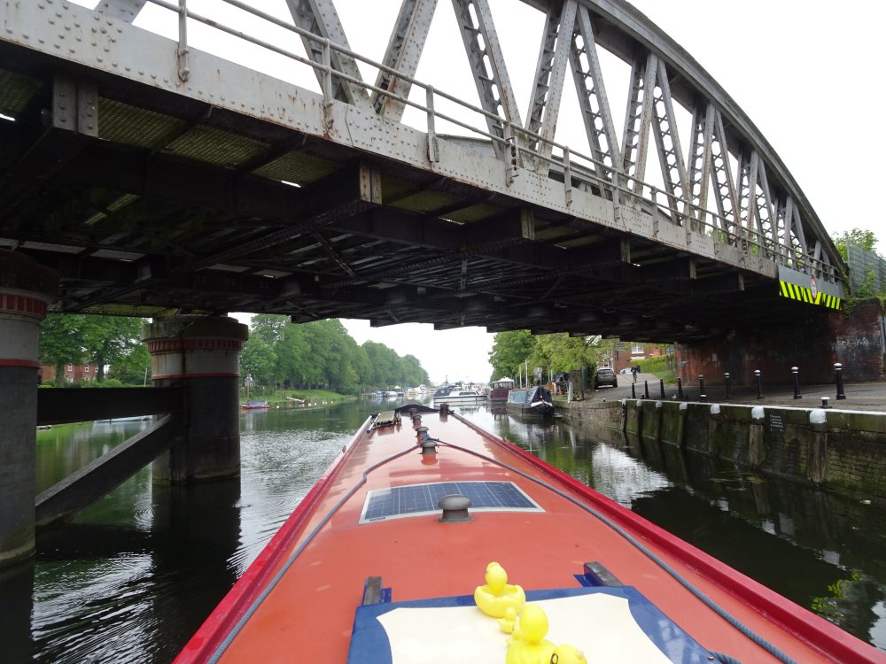
Ian had to go home for a medical check up on Tuesday (no problems) and took the opportunity to leave the car in Yorkshire, returning on Wednesday by train.  So we set off properly on Wednesday afternoon.  This is the view back towards Boston Stump as we passed a rower on the River Witham.

We spent Wednesday night moored on the pontoon by Anton's Gowt Lock and went through the lock on Thursday morning.  The lock lets you down about 4 feet off the river onto the 'Witham Navigable Drains', a network of fenland drains that can be navigated during the summer months when they are kept full for watering the fields.  During the winter they are kept at a low level to take possible flood water.  There are said to be over 100 miles of navigable water but some drains have bridges that are too low.  We've done bits of the network before and this time our first objective was the Maud Foster Drain to secure a Silver Propellor point.  The picture above is taken from the drains side of Anton's Gowt.  The white ladder is the lock landing on this side.  Quite tricky.

The first channel we used is Frith Bank Drain.  This was a bit weedy (which is a problem with the drains in the summer months) but not too bad.  It is twisty and attractive with bridges like those common on canals.

After a few miles on Frith Bank Drain the waters open out and on the right is Cobbler's Lock.  This takes boats up a couple of feet to a different set of drains.  The bottom gates are 'V' gates but they have no balance beams.  You can open them by pulling the chains but closing them is a bit tricky.  Helen and the chap on the left gate used their feet and  Ian pushed from the boat.

Having turned right above the lock we followed Maud Foster Drain to the windmill of the same name which, unusually, has five sails.  We have turned round between the brick walls below the mill, but it is very tight so this time we went under the main road bridge and turned between grassy banks below that.

Helen had read that boats could go down almost to the sluice at the end of this drain which lets the water into the tidal River Witham.  Indeed we had passed the other side of the sluice coming off the Wash into Boston.  However to get down to the sluice there are two more bridges to go under.  The first one looked OK but Helen confirmed that Leo was about an inch too tall to fit under it, so back we came and turned round.

We moored to rings in the wall below the windmill and came ashore to take this picture to earn our Silver Propellor point.  The windmill unfortunately was shut (it opens on Wednesdays and Saturdays) but the sails were turning.

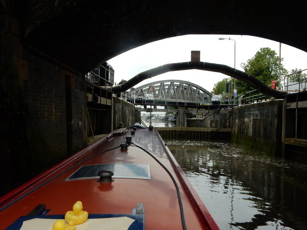
After lunch we returned to Cobbler's Lock which you'll see has a guillotine gate on the upstream side.  No lock landings either side for this lock.  Here you have to nose in carefully past the hawthorn tree to the guillotine gate and then Helen managed to climb off the boat onto the side of the lock.  Some golfers were amused to see a boat going through the lock as this is a relatively rare event but did not volunteer to help with the manual guillotine.

Having got back through Cobbler's Lock we cruised up Medlam Drain for about five miles to this wild mooring for the night.  Medlam Drain starts out very wide but after several junctions reduces to more canal style width and certainly not wide enough to turn Leo.  We spent the night opposite an owl box hoping to see any occupants but perhaps it was empty as we didn't see any owls.  It was a lovely quiet spot though.

On Friday morning we carried on up the Medlam Drain for about 3 miles to where it joins the New Bolingbroke Drain.  Here it was a bit shallow but we managed to turn the boat by pushing the bow round with a pole.  This view shows the Medlam Drain going straight on and you can just make out the other drain on the left.

This picture was taken by Helen, at the bow with the pole, looking past Leo's stern up the New Bolingbroke Drain.  Once turned round we retraced our outward route going through Anton's Gowt and mooring on the same pontoon as on Wednesday night on the river side of the lock.  A fun excursion and, as regards the Medlam Drain, somewhere Leo has not been before.  The top end of this drain is quite scenic with trees and bird life and the banks are low enough in places to see the surrounding countryside including the hills of the Lincolnshire Wolds just a few miles to the north and beyond the Fens.

On Saturday we carried on up the River Witham.  This photo is of Langrick Bridge.

Though the weed growth on the Witham suggested that there might be a problem nevertheless we decided to try going up the Kyme Eau or Sleaford Canal which can in appropriate conditions be navigated for about 7 miles to and beyond South Kyme village.  We tried this in 2015 and were stopped by weed growth and in 2017 we managed it by going earlier in the year before the weeds had grown.  This photo shows us going past moored boats before flood gates mark the entrance to more challenging waters.  We did ask the boaters here about the weed but no-one seemed to know.  So we pressed on.

This photo is looking back to the flood gates having got through.  Once we'd stuck our bow through it was clear that there was quite a lot of weed but this seemed to be only for a few yards and then there was clearer water.  So on we went.  The prop wash was a curious light green colour and heavy weeds lurked just below the water.  But Leo was going fine so we carried on for a mile and a half to Lower Kyme Lock.

We turned into the lock cut and moored below the lock while we walked up above to look at the state of the canal above the lock.

This is what we found.  The area to the left of the flowers is the "water" and to the right is the land.  This dense carpet of weed, caught by the lock and the weir sluice, extended for about 150 yards and after that the water was a little clearer.  We debated carrying on but decided not to.  In 2015 we had been obliged to pole the boat backwards for 200 yards to escape the Kyme Eau and we decided we didn't want to repeat that.  Added to which we knew there were other complications further up the canal.  So discretion ruled.


We reversed to the junction of the weir stream and lock cut and Helen's expertise with the pole came in handy again.

The Kyme Eau was full of wildlife though.  Helen caught this swan in the act of taking off.  You can see its footprints in the water.  We also saw a grass snake swimming across in front of the boat and a huge fish about 2 feet long leap clear out of the water.

This is our track through the weed as we coasted back through the flood gates and back onto the safety of the River Witham.

Having got back on the River we carried on a few miles to Tattershall Bridge where we spent two nights.
On Sunday we enjoyed a visit from our daughter Lucy and partner Becca and not to forget our little grandson, Nathan.  We hadn't seen them for a couple of months and Nathan proved to be a cheery chap with big smiles on his first visit to a narrowboat.  Maybe as we get too old, he can work the locks for us!

Today we've come further up the River Witham but that is a story for another day.  We are heading to Lincoln in the next couple of days so I'll do another update then.

Monday 20 May 2019

Crossing the Wash from Wisbech to Boston

Yes, we've done it!  On Saturday (18th May) we crossed the Wash from Wisbech to Boston.  Out to sea and out of sight of land (well it was a murky day).  We were accompanied by Daryl Hill as pilot.  We thoroughly recommend using Daryl.  His fund of knowledge and experience gave us great confidence in the enterprise.

At the end of our last posting, Leo was on the floating pontoon below Dog in a Doublet Lock and the first challenge was to get ourselves to Wisbech.  We left at around 9.30 on Friday, about half an hour after high tide.
It has to be said that the tidal River Nene is not that exciting or scenic.  It was mostly pretty straight with high banks so that a herd of cows was a cause for celebration, especially as they seemed frightened of the boat and we herded them along the bank.  This picture shows the only bridge on the 15 mile trip, at Guyhirn.  This is just after the channel called Morton's Leam joins the river.

After Guyhirn there are more houses and we soon came into Wisbech.  Here the channel has concrete or steel pilings alongside and is narrower and therefore faster.  We had been trying the keep our speed down to about 6 mph over the ground but here that was not possible.  To the right you can make out the first of two bridges through the town which are both on fairly sharp bends.  Not that easy to navigate with the current behind you.

Here is the second bridge with the yacht harbour beyond.  Well it's called a harbour but all it consists of is a series of pontoons coming out into the river.  This of course makes the navigable channel even narrower.

Having passed the boats and the moorings we passed a ship (unusual in a narrowboat) and then followed advice from Daryl and turned into the mud bank beyond the ship.  We buried the bow in the mud and the current whipped the stern around.  Lots of revs then to push back against the strong current past the ship and in to moor on the nearest pontoon where we had booked a space.

And here is Leo moored on the visitor pontoon.  We arrived about midday, so that is 15 miles in two and a half hours - not bad speed on a narrowboat.  Later in the evening at high slack water (about an hour and a half after high tide - can you work out why?) with help from another moorer we turned Leo to face downstream for the following day.
So that was Friday.  On Saturday morning we were up early as Daryl arrived about 7 am ready for our Wash adventure.
We set off about 7.45 when we were sure that the tide had turned to ebb.  At first the river was little different to the scenery on Friday.  We passed the big boat lift where our friends' broadbeam, Violanthe, was lifted out, then on down the straight river.  A pilot and a survey boat passed us.  Given the wash they were making it was nice of them to slow down past us and then speed up again.

There's only one bridge between Wisbech and the sea, a swing bridge called Sutton Bridge or sometimes Cross Keys Bridge.  It reminded us of the swing bridges on the River Weaver.  We didn't need the bridge swung as we can squeeze underneath.

Here, below Sutton Bridge, Daryl is pointing out something to Ian as we pass the line of boats moored there.  It was raining at this point but fortunately it cleared later.  By this point the river is wider.

We passed another ship, Eems Sun, which brings building materials from Eastern Europe.

There are two lighthouses at the mouth of the River Nene - this is the East Lighthouse.  One of them used to be the home of Sir Peter Scott before he went to the West Country to found Slimbridge.

And so, about 10 miles downstream from Wisbech we headed out to sea.

Mudbanks on our right had congregations of seals.  These are probably common or harbour seals.

Here is Leo on the high seas!  As we came down the last of the river there were waves coming towards us and, once at sea, Leo was pitching a bit in the waves.  We soon realised she was not going to sink and in fact rode the waves pretty well.  And Daryl remained cool and unruffled so obviously this was normal.

We certainly look pretty cheerful in this picture, though the wonky horizon gives an idea of the conditions.  You can see the land receding behind us.  The channel marked by buoys zigzagged about and we were often going in odd directions until we passed the Nene Roads buoy and from then on we were beyond the channel and in open water.

The sea was a little choppy on this stretch and the bow fender is taking a ducking here.

Our son, David, had joined us for this crossing and here Daryl, Helen and David are shown in weather which was noticeably improving.  We even had odd spells of sunshine, though distant views were quite murky.

After a few miles going broadly north in open water we saw the first buoy - Alpha - of the channel into Boston.  Once we turned into the channel, the sea was much calmer.

By this time the tide had fallen and sandbanks were visible all round us.  On this sandbank were some Brent Geese which we had not seen before.

Daryl encouraged us to pick up speed as we were going now against the last of the tide and had to get over a sand bar to find the best place to beach the boat while the tide turned.  We crept slowly across the bar but did not catch.  The waves looked different here, marking the shallows.

By this point, having cleared the bar, we were cruising along with sandbanks either side.  Daryl then told us to turn through 90 degrees and head for the sand.  Having put our bow on the sand, David then took off his shoes and socks and carried the anchor onto the bank and pushed it into the sand.  So we were fixed for the next hour and a half while we waited for the tide to start to flood in.

This is the first time we've used the anchor.  It was proper sand, not muddy at all, and we walked across the bank to the other side.  We were effectively moored to an island in the middle of the Wash.

Here is Leo marooned on a sandbank. 

Time to get back onboard having explored our island. We enjoyed a lunch of bacon butties and salad.  We had beached about 1.15 pm and had just finished lunch when we noticed the tide was coming back.  David hoisted the anchor as soon as Leo was properly floating and we backed off before turning the bow towards land.

More seals watched us passing.

Here we are approaching the mouths of the Rivers Welland (to the left) and Witham (to the right).  We kept to the right and then turned into the River Witham.

It was still fairly low tide and we came up the river with the tide between mud banks on either side.  Though we had spells of sunshine it was now rather grey again.  There are pylons in the distance carrying cables over the river but the second tower from the left is Boston Stump, the tower of the church of St Botolph's in the town.

As we came up the river we passed a fleet of fishing boats moored outside the dock, on the river.

At one point we came through a narrows where high steel piling narrows the river.  This is where they are building the new Boston Barrage designed to prevent flooding in the town.

Though there was a fair bit of mud on either side we later saw what this looked like at low tide - just a tiny stream down the middle with mud everywhere else.  The River passes the fine historic buildings and goes just below the Stump under numerous bridges.

Finally we came round a bend and saw the Grand Sluice in front of us.  The lock is to the right of this structure but we had to wait for 10-15 minutes until there was enough water to let us in.

Here is Leo going into the lock.  The lock is in fact too short for Leo and we were expecting to go straight through 'on a level'.  However the lock keeper closed the outer 'sea doors' which have the 'V' of the gates facing the tidal water and we then waited until the tide rose to keep those gates closed so that it was possible to open the river gates and let us out.  At Daryl and the lock keeper's request we experimented with closing the normal lock gates on Leo.  Without fenders this would have been possible so I guess the lock would in fact take a 55 or 56 foot boat, though fitting two in side by side would not work.
And here is Leo coming out of the lock onto the non-tidal River Witham where we are now moored a short way up on the visitor moorings.  We arrived about 5.30 pm.  We had a great day crossing the Wash and would recommend it.  Take a pilot, better still take Daryl as pilot and make sure your boat is reliable with new fuel filters and a clean diesel tank and only do it when the weather conditions are suitable.  Our forecast was for winds up to force 2 or 3.  Any more would have been scary.  At no point did we feel the boat was being stressed and engine revs were generally much less than doing the Ribble Link or the tidal Severn.