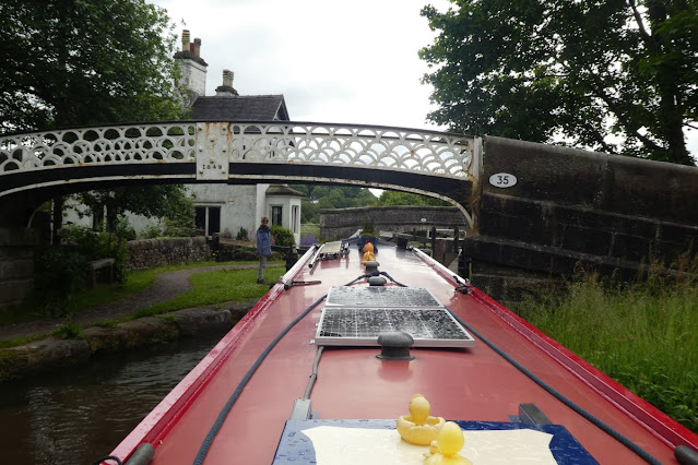
Friday 24 June 2022

Descending the Anderton Lift

 We are now down 50 feet from the Trent and Mersey on the River Weaver after coming down the Anderton Lift this afternoon. So I thought it would be interesting to share some photos of our descent. Normally the lift has two caissons each capable of holding a wide beam boat or two narrowboats. Usually one caisson goes up as the other goes down. However at present only one caisson is working so passage is restricted and you need to book passage rather than just turning up and waiting your turn. However we booked our passage only yesterday so there didn't seem to be much problem, indeed a phone call after our arrival gave us the option to go down an hour before we had booked as there was a cancellation. We have however also booked our return for next Monday, so let's hope it's still working then!

Here are some pictures of the process. You have to arrive on the waiting moorings at the top half an hour before the lift time.

Here is the view of the lift from the River Weaver below. The level approach to the right at the top connects with the Trent and Mersey Canal (Anderton is between Middlewich and Preston Brook).


Once we were given the 'all clear' we turned into this level section passing under the first of two gates seen here. The industrial works you can see to the left of the lift is in fact on the other side of the Weaver below.

Once we were through the gate we stopped, waiting for the cabin cruiser that was supposed to come down with us. For some mysterious reason he missed the turn (how embarrassing is that) and after waiting some time, we went down alone. Beyond Helen on the bow and at water level you can see the barrier that needs to be lifted before we can move forward into the caisson.

This view is taken looking back and shows the gate descending and closing off the access to the Trent and Mersey behind us. Presumably this is so that, if something goes wrong then the lift does not drain the canal.

Here is a view looking down to the River Weaver some 50 feet below us. The view is looking upstream towards Northwich.

Once the water gate in front of us was raised the lift attendant beckoned us into the caisson. A gap between the double gate behind us was then emptied of water and the two linked gates separated so that the caisson with its water can be lowered. Here we are still at the top - notice the white railings to our left and compare that to the next photo.

This photo is taken part way down and you can see the white railings are now above us. The movement is extremely smooth and slow and it is easy not to notice that you are going down. I did try to post a video showing just how slow the descent is, but unfortunately it doesn't seem to work on Blogger. It takes about 10 minutes to go down but that is a lot quicker than 5 or more locks.

Here is a view looking up once we were near the bottom of the lift at River level. Through the grill overhead you can see the gear wheels that used to work the lift when each caisson was suspended by cables from the top. The lift started life as hydraulic and was later converted to electricity with cable suspension because the river water corroded the hydraulic rams. Finally in 2002 it was converted back to hydraulic power with high tech ceramic rams below each caisson. It appears that erosion of the surface of the ram is once again causing problems and is the reason the west caisson will be out of action for the rest of this season.

Here again looking up you can see the gear and pulley wheels.

I took this view looking back as we drove Leo out of the lift at the bottom, having waited for a similar double gate to be lifted. You can see the right hand caisson is open where we have just left.

And here once more is the picture from down below showing this wonder of the waterways with its Victorian engineering.
So we hope that was interesting and now look forward to a few days on a river. We've been on the Weaver before and it is certainly worth a visit. After we return to the Trent and Mersey we will be heading north to Liverpool.

Friday 10 June 2022

Caldon Canal Delights and Challenges

 We've now explored as much of the Caldon Canal as a narrowboat can. People often ask us which is our favourite canal? Well the Caldon Canal must certainly be in the top three. It has so much variety - a staircase lock, two tunnels (one barely navigable), an intriguing junction, beautiful contryside and places of interest nearby. It is however quite a challenging canal and should not be cruised if you are expecting an easy time. It is often narrow and shallow and the offside is badly overgrown (or at least that has been so in 2022). So here are some photos of its key features with information added.


The day we arrived (Sunday 5 June) was the second day of a canal festival at Etruria where the Caldon Canal turns off the Trent and Mersey near Stoke on Trent. Lots of historic narrow boats were moored two abreast making it difficult but not quite impossible to navigate through to the Bedford Street Staircase Locks.

Bedford Street is a staircase of two locks which rises nearly 20 feet.

Once up the staircse the canal continues on the edge of Stoke. Two bottle kilns have been left in a modern housing development, so you know you are in the Potteries.

After a further lock we came through Ivy Lift Bridge, fortunately electrically controlled. Though the advice is not to moor overnight in Stoke on Trent the towpath was closed above this bridge and so we decided to chance an overnight mooring. It had been a very wet morning as we came up the five deep locks at Stoke and we needed to stop. In fact we only saw one person pass along the closed towpath and had no problems.

Here is a view of the stones forming a wall of one of the five Stockton Brook locks. The star shaped mark is a mason's mark when this lock was built in the 1700s. Fascinating to think of a man 250 years ago inscribing his mark for the future.

Approaching an old canal arm at Endon there is a small roundabout in the middle of the canal. Boats are directed to the left and clearance is very tight. So why is this curious obstruction there?  The answer is that this was a pivot for a railway swing bridge for a mineral line that crossed the canal here to reach the main line. The canal arm is now the home of the Stoke on Trent Boat Club.

We moored on Monday evening near Park Lane Services and walked around local villages. In Endon Bank we found the well dressed for the well dressing ceremony over the weekend. The patterns are formed of real flowers.

Endon Bank also had a Jubilee decorated phone box!

On Tuesday morning we cruised on to the junction at Hazelhurst. The photo is of the signpost. We had come from Etruria and the two branches go to Leek and to Froghall. To go to Leek you turn right and then swing left to cross on an aqueduct the branch to Froghall which by this point has dropped down 3 locks to pass underneath. Like a few other canal junctions it is most similar to modern motorway junctions.

We took the Leek branch first and near the end of this branch is a short tunnel.

From the end of the Leek branch there is a steady climb to visit the attractive town of Leek. It does however have an excessive volume of heavy and noisy traffic. This view up Church Road shows some of the historic buildings.

This view looking back shows a very tight turn coming out of the very narrow bridge on our return along the Leek branch.

We moored on Tuesday evening on the Leek branch close to the Hazelhurst Junction. It was a lovely spot with a fine view opposite.

Wednesday saw us turning sharply right at Hazelhurst junction to drop down the 3 locks on our way to Froghall. Here we are going into the top lock.

And underneath the Leek branch on an aqueduct built by John Rennie in 1841.

We soon passed the Flint Mill at Cheddleton. Here flints were baked in a furnace and then ground by a water mill to a powder used in the pottery industry.

A few locks further down the canal which follows the valley of the River Churnet we came out onto the river itself for a mile and a half or so. The river is fairly fast flowing and has a series of sweeping bends. Keep to the outside of the bends if the river level is low to avoid beaching on a shingle bank.

As the canal continues down the valley the Churnet Valley Railway accompanies it. At Consall Forge where the canal turns off the river it passes under the railway. We were so lucky to find that a steam hauled train arrived at the same time.

The passengers on the train waved to us on the canal below them. A little further on the platform of Consall Station is actually cantilevered out over the narrow canal. This is one of a number of sections where the canal is too narrow to allow two boats to pass each other. Fingers crossed there is no boat coming the other way!

This bridge is called Cherry Eye Bridge. Its arch has a rather novel shape. The name comes from the ironstone miners here who used to rub their eyes with red stained hands giving them cherry eyes.


Near the end of the Froghall branch of the Caldon Canal is a tunnel which we think is the second lowest on the system. It is only 76 yards long but is so low that most boats cannot fit through. We had done it before so we knew that Leo would fit through but it is very tight even so. At the last lock before this point - Flint Mill Lock - there is a gauge below the lock that you can use to measure whether your boat will then fit through the tunnel. The gauge is slightly pessimistic. To get through we turned the engine off and pulled the boat through using hands on the roof of the tunnel. Doing this means with Helen on the front and Ian on the back we can talk to each other and take action when the rails at the top of the boat are close to touching. This photo is taken in fact on returning through the tunnel but it does show how close the clearance is. In fact we picked up a few scratches on the way through and none at all on the way back, but we did fill with water before returning and put the anchor on the foredeck and two water filled toilet cassettes in the well deck.


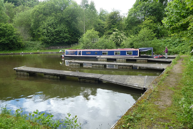
On the other side of the tunnel you can turn right through a lock which lets you down to a delightful canal basin that would hold 8-10 boats. Because of the difficulties with the tunnel we were on our own! In fact the lock and the basin formed the first part of the Uttoxeter Canal which used to go to the town of Uttoxeter about 13 miles away. Much of the course of that canal now has a railway track along it and there is little prospect of it being restored beyond this point.
So there you have it - the Caldon Canal. It is certainly one of our favourites.