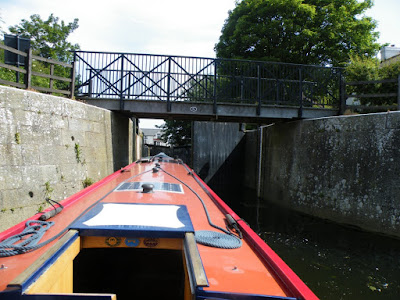
Here is Leo moored on the far side of the Glory Hole. This is a short tunnel under 16th century shops on the bridge above. This also acts as a barrier to the big fast cruisers from the marina above Lincoln.
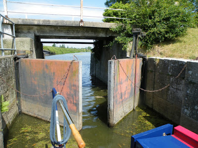
As you come out of Lincoln there is the first of two locks between here and Boston. This is Stamp End Lock which has a guillotine gate at the upper end. This picture is taken from Leo waiting while the gate is lifted by Helen's finger on the button.
If you look carefully at this picture of the River Witham looking back after a few miles, you can just see Lincoln Cathedral on top of the hill in the distance. Long views are common on these flat fenlands.
We spent Tuesday night at Fiskerton Fen, a nature reserve which we had a walk round in the evening. The picture below shows the lake which was created when clay was extracted in order to reinforce the river bank for flood protection.
At Bardney we passed a Sugar Beet Factory. Nothing was apparently being processed presumably because it is not yet harvest time.
At Kirkstead there used to be an abbey before the dissolution of the monasteries in the 1540's. It surprised us how tall this was as it is the only remnant left.
Close to the remains of the abbey is St Leonard's Church. This was built in the 13th century and has remained pretty well as built up to the present day. It is well worth seeing, but you need to visit a nearby farm to borrow the key.
The wooden Chancel Screen inside dates from the 1200's. Not particularly ornate but amazing that it has lasted for 800 years.
Leo is moored in this picture by Tattershall Bridge. The old arched bridge is no longer in use - it leads to a brick wall! You can see the modern replacement behind.
Tattershall Castle was a very early brick building having been erected in 1460 by Ralph Cromwell, the Treasurer to Henry VI. It has two concentric moats but was primarily a country house built to impress.
Here is the fireplace in the Audience Chamber - again built to impress the Cromwell's visitors.
The view from the Castle is impressive. The funny little house is the Guard House and now the National Trust Gift Shop. Above this and to the left of the church is the line of the Horncastle Canal, sadly no longer navigable.
Here is another view of Lincoln Cathedral, this time from Tattershall Castle. Lincoln is about 17 miles away in this view.
A disadvantage of mooring at Tattershall is the screaming noise of the Tornadoes flying overhead. RAF Coningsby is next to the Castle and the aerobatics were certainly entertaining.
We wanted to stop close to the turn to the Sleaford Navigation (also known as Kyme Eau) but we were unable to find a mooring so we carried on to Langrick Bridge last night.
Today (Friday) we came into Boston. There is a direct route which we may try tomorrow but we have followed the 'Navigable Drains' to come into town by the back door. There are many miles (probably over 100 miles) of 'navigable drains' whose main purpose is to drain the fens round here. A few of these are more reliable in terms of depth of water, height of bridges and places to turn round. First we came through Anton's Gowt Lock which drops you down a further 5 feet or so, probably to below sea level. After a couple of miles along the Frith Bank Drain you come to Cowbridge Lock which lifts you back up a couple of feet. There is then a further mile and half into Boston along the Maud Foster Drain.
Here Leo is coming in to Anton's Gowt Lock. This bit is fairly easy though the lock has massive gates at the top end and no landing stage below. Poor Helen had to climb down a long ladder to get back onboard while Ian held Leo close enough to the high wall.
The Frith Bank Drain is much smaller than the River Witham and looks like many Midland Canals, though the weed for the first mile was a bit thick and coated the prop in its characteristic way.
This view is looking back from Cowbridge Lock. We had come through a bridge to the left but the long straight waterway is the West Fen Drain, another apparently navigable waterway.
There is no landing stage of any description at Cowbridge Lock. Here Helen is trying to climb off the boat to work the lock. She did succeed, but it is not easy. All these waterways are primarily drains. Navigation is certainly a secondary use.
The lower gates at Cowbridge are very unusual. They have no balance beams at all. You open them by tugging on the chains and close them by pushing with feet, hands, boat or whatever comes to hand. Opening the guillotine the other end finished the closing of the gates.
The guillotine on the upper end of Cowbridge Lock is manually operated by turning a handle, but it was nothing like as hard as some guillotines on the River Nene. The main problem with this lock is the lack of any landing stage above or below. Ian had to hold Leo right by the guillotine while Helen lowered it, so that she could get back on.
This picture is looking North up the Stone Bridge Drain as there is another junction of waterways above the lock at the slightly higher level.
The views entering Boston down the Maud Foster Drain reminded us of Holland with houses and trees either side of a fairly broad waterway. The windmill added to the Dutch feel. This is the Maud Foster Windmill which, as you can see, has five arms.
There is a strict embargo on going under the next bridge in the picture. Not sure why, but this means you have to turn within the high brick walls. Nicholsons' Guide says you can turn a 60 foot boat. Leo is 57 feet long and we had an inch to spare, possibly two! And here we are moored after turning. There are some mooring rings in the wall and some steps.
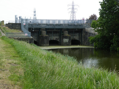
We've been walking round Boston this afternoon and first carried on down the Maud Foster Drain. No way out at the end as this sluice controls the flow into the tidal River Witham.
We like Boston. It has some fine old buildings, large squares and the amazing St Botolph's Church known as Boston Stump. We hope to go up the tower tomorrow to see the view. Here are some initial views of Boston:
This is Hussey's Tower which is an even earlier brick building than Tattershall Castle, being built in 1430.
This fine Georgian house is known as Fydell's House after an early owner. It has a lovely garden which you can also visit. Rooms are available for hire but visiting is very informal. Just open the door and wander around.
This is the oldest building in Boston. Originally a Dominican Friary rebuilt in 1309, it has now been converted to a community theatre.
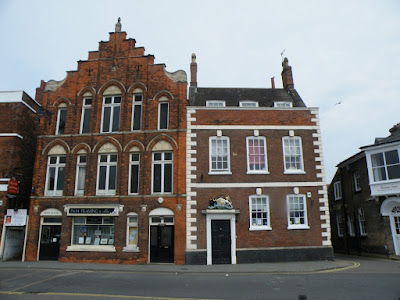
South Street is full of fine old buildings including these two. The one on the right is the second oldest Customs House in the country. We'd like to know where the oldest one is.
We will probably spend a few days here, perhaps cycling to the sea at the Wash. Seagulls are already much in evidence. We will possibly go up Boston Stump tomorrow and then move Leo to the normal mooring on the River Witham where we are less at risk of floods than here. After seeing Boston our way lies back through Lincoln to Torksey where we will have our last foray onto the tidal Trent up to the tidal limit at Cromwell near Newark.


No comments:
Post a Comment
If you ask a question in a comment it may be worth knowing that for some reason at present I am unable to reply to a comment unless you choose to let me have your e mail address.