Yes to the very end my friend (thanks to Christina Rossetti). Well the Llangollen Canal
is uphill as it was built primarily as a feeder to supply water to the rest of the Shropshire Union system and so has a continuous flow from its source on the River Dee down to the reservoir at Hurleston at the start of the canal. The result is that where the canal narrows at bridges and tunnels and aqueducts extra throttle is required just to make sure that the boat does not come to a standstill. That difficulty aside, it is a lovely canal as we hope this update to our blog will show. I have been trying to update the blog for several days but we are in remote regions where the phone does not seem to have enough grasp of the internet to share it with the laptop. There are a lot of pictures in this posting.
 |
| This canal
has quite a few lift bridges. This is Wrenbury Church Lift Bridge. The smaller ones like this are lifted by using a windlass to wind it up
hydraulically. Helen is about to lift this one to allow Leo underneath. |
 |
| A little further on is a much bigger lift bridge at Wrenbury Mill. Fortunately this one is operated electrically, so all that is needed is a waterways key to hold up the traffic. There is a boatyard to the right where hire boats are let out. |
 |
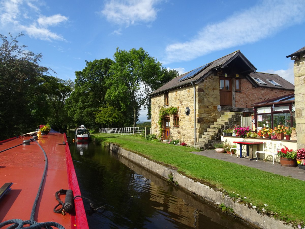
| Leo is shown here below Willeymoor Lock. There is a good pub and cafe beside the lock. |
 |
| Last Wednesday (4th September) we came to Grindley Brook. Here the canal is lifted by three single locks and a staircase of three more. At the bottom is an old railway bridge and getting through the narrow channel under the bridge was quite a struggle because of the flow against us. The picture is looking back to the middle lock of the first three. |
 |
| And here we are looking back from the lock at the top of the staircase. |
 |
| This is
the lift bridge at Whitchurch a little further on. Here a lady from
another boat was lifting the bridge and kindly let us through. We
decided not to stop at Whitchurch this time, but may stop there on the
way back. |
 |
| On Wednesday evening we stopped a couple of miles beyond Whitchurch and carried on into Ellesmere on Thursday. This is the land of lakes called meres which were left over by the retreat of the glaciers at the end of the last ice age. The picture above is of Blake Mere which the canal goes round giving glimpses of the water through the trees. |
 |
| Round the corner from the mere we came to Ellesmere Tunnel. This is only 87 yards long but it has a towpath running through it and it is very narrow so there were times when we were going so slowly against the current that Leo was struggling not to go backwards. |
 |
| There is a short arm at Ellesmere heading to the town and to a handy Tesco at the end of the arm. We moored on the arm and walked into town. The mere here (guess what this one is called!) is large and has a pleasant cafe beside it where we had lunch. On the hill above where there was once a castle some sculptures have been set up and here the photo is looking through a stone sculpture to the mere below. |
 |
| From the top of the castle mound there is an extensive view. The prominent hill to the south is Breiddon Hill which has a pillar on top called 'Rodney's Pillar' after an admiral who defeated the French in 1782. |
 |
| Intriguingly, the flat top of the castle mound is used as a bowling green. This view looking over a lower green shows the church and the mere beyond it. |
 |
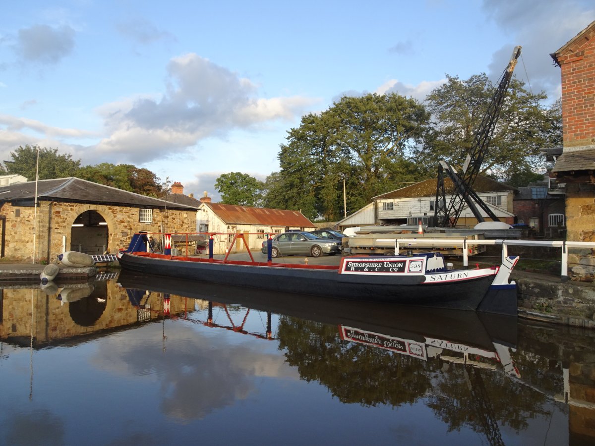
| Near the junction with the arm into town is an old British Waterways yard and the picture is of Saturn, an old Shropshire Union Fly Boat built in 1906. Fly boats were fast and travelled day and night with priority over other boats. They were horse drawn and travelled at the dizzying speed of 6 or 7 mph. Saturn had just had a new coat of paint and looked wonderful. |
 |
| On the bend by the junction is this house which was constructed by Thomas Telford and was once the canal company's office. We loved the circular bay window. |
 |
| On Friday morning we passed Frankton Junction where the Montgomery Canal turns off down four locks. We will go this way on our return. Here is the signpost at the junction. For now, our way was set for Llangollen and on Friday we crossed the border into Wales. |
 |
| The last two locks on the canal at New Marton we did in the rain. There are some fierce bywashes below the locks on this canal and above the bottom lock we somehow got ourselves stuck on the weir. We had to use a lot of throttle to get off here and scraped the base plate all the way along the weir. It's a good job Leo is going to have her bottom blacked over the winter! |
 |
| The warm colour of the stone round here is delightful as this old converted barn at St Martin's Moor shows. |
 |
| We love this hobbit hole seen beside the canal through Chirk Bank. |
 |
| The last few miles of the Llangollen Canal are pretty spectacular and it all begins with the Chirk Aqueduct seen here. The canal aqueduct and the railway viaduct run side by side across the valley of the River Ceiriog. |
 |
| On the Welsh side of the Chirk Aqueduct there is a small basin and then the Chirk Tunnel. Like the aqueduct, the tunnel is only wide enough for one boat at a time so you have to look ahead for any headlights of boats coming towards you. We were lucky and it was all clear. The current through the tunnel made it difficult to make progress and to stay off the sides. A towpath runs through the tunnel which is 459 yards long. |
 |
| Beyond the Chirk Tunnel is another short tunnel (Whitehouse - 191 yards) and then the canal goes through Froncysyllte shown here before turning sharp right to cross the famous Pontcysyllte Aqueduct. |
 |
| Through the trees we caught just a glimpse of the Pontcysyllte Aqueduct crossing the valley of the River Dee. This is another of Mr Telford's splendid creations. |
 |
| Froncysyllte has an overbridge for pedestrians and a small lift bridge for cars. |
 |
| The canal is carried in an iron trough 120 feet above the River Dee. It is unnerving to look over the side of the boat and down to the water. The edge with the square holes seen here is about 4 inches wide and the iron is about three-quarters of an inch thick. |
 |
| There is a towpath across the Aqueduct which is cantilevered over part of the water channel. Above the river is this innocuous looking handle. Pulling this up empties the water from the Aqueduct into the River Dee below. Fortunately it is bolted down. You can buy postcards showing the effect when the stopper is pulled. |
 |
| This is the nearest thing to flying on a narrowboat! |
 |
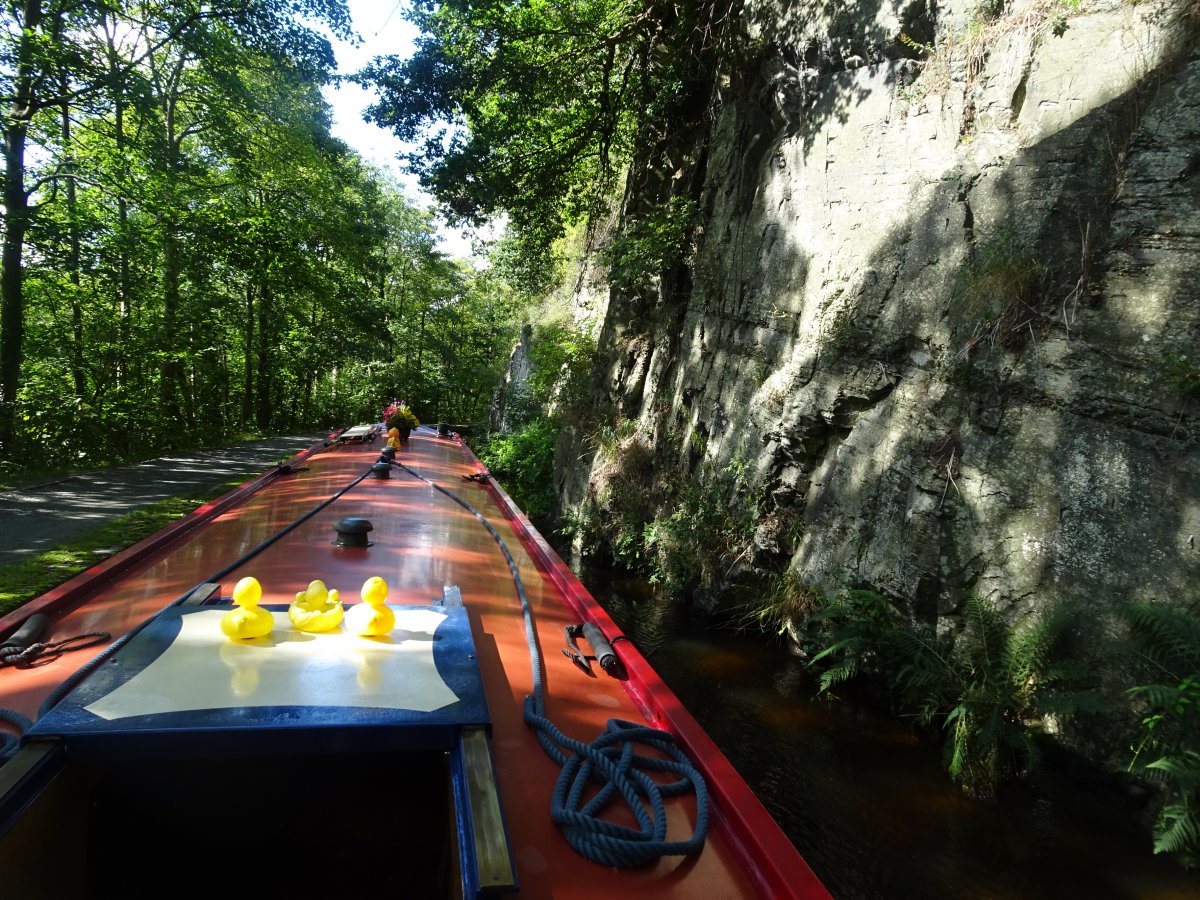
| The four miles from the north side of the Pontcysyllte Aqueduct to the terminus of the canal at Llangollen primarily served and still does serve as a feeder to bring water to the Shropshire Union Canal system. It is navigable (just) but it has shallow spots and three sections where it is only wide enough to allow one boat at a time. Helen got the bike out and cycled ahead to check if there were any boats coming towards us and we used our two way radios to report that the coast (or canal) was clear before venturing onto these sections. The first section is about 300 metres long and has a passing bay half way but the second one shown here is about 500 meters and there is no passing bay but only a cliff face on the side away from the valley. The third section is much shorter and is just as you reach the town. |
 |
| Fortunately there is ample mooring available at Llangollen both in an offline marina and on the canal itself (£6 a night for a maximum of 2 nights but it includes electricity). A horse drawn boat takes visitors another mile and a half along the feeder canal to the Horseshoe Falls but powered boats must turn at the basin. One of the boat horses is shown here. |
 |
| Having moored in the marina we walked down to pay our dues and explore. This view from the bridge shows the canal coming into Llangollen. The nearest of the narrows starts by the house. |
 |
| The River Dee forms a cascade through Llangollen which is a temptation for thrill seeking canoeists and white water rafters. |
 |
| In the afternoon we walked up the feeder canal passing this pretty cottage.... |
 |
| and Harley pulling the latest group of tourists. |
 |
| Right at the end of the channel is this metering house which allows water into the canal. |
 |
| And this is where it comes from - a huge 'J' shaped weir on the River Dee, built by Telford and now called the Horseshoe Falls. |
 |
| We had a day off from boating and caught the steam train from Llangollen to Glyndyfrdwy (this is pronounced 'GLYN-DOVE-DWEE') and walked to the next statiion up the line at Carrog to get the train back. We were lucky that Sunday was a glorious day much more like summer than we have been having lately. The picture is of Glyndyfrdwy Station at the start of our walk. |
 |
| Around Llangollen you really feel you are in the hills. We climbed up above the Dee Valley and had some wonderful views. Here we have stopped for a picnic lunch and are enjoying views south west to the Berwyn Mountains. |
 |
| We came down from the hills through a forest and spotted this Speckled Wood butterfly. |
 |
| We crossed this bridge over the Dee at Carrog and the river looked so inviting that we walked down to the river meadow, took off our boots and had a paddle, particularly as we had plenty of time to wait for our train. |
 |
| Here we are on the station at Carrog and, earlier than we expected, this train came in. It proved to be a 'driver experience' train and not ours which turned up on time half an hour later. We made good use of the station buffet which served excellent carrot cake and had a good browse round the second hand book stalls. |
 |
| Our mooring fee covered us until 5 pm on Monday so we decided to visit Plas Newydd on the far side of town. This house was occupied by the 'Ladies of Llangollen', two ladies who lived here for fifty years together. They collected carved wood from 16th and 17th century furniture and medieval church carvings and made wall panels which now cover the internal walls and some of the exterior. The two ladies and their servant are buried in the church in the town and commemorated together on a triangular monument. |
 |
| We explored the gardens at Plas Newydd and admired the lions: having a boat called Leo we always admire lions. |
So that brings us to the end of the Llangollen Canal and it is definitely downhill back to the Shroppie. On our way back we have diverted onto the Montgomery Canal, but more about that in our next posting on the blog.


One of my fellow Countryside volunteers is a train driver (again voluntary) and he took us on the railway and we walked along the bit of canal to the rather under-whelming Horseshoe Falls
ReplyDelete